‘Farmers’ Almanac’ Predicts Cold, Snowy Winter
- Share
- Tweet
- Pin
- Share
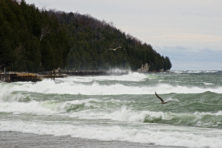
Winter is coming.
And if you ask the folks at the Farmers’ Almanac, Midwesterners are in for a cold and snowy one. The longtime purveyors of mostly accurate long-range weather predictions released their 2017 issue in August and with the official start of winter just a few days off, it’s feeling pretty accurate.
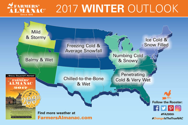
Old Man Winter will be back, with the publication’s forecaster Caleb Weatherbee (a pseudonym the publication uses for all of its weather forecasters, past and present) calling for “exceptionally cold, if not downright frigid weather” in the Northern Plains, Great Lakes, Midwest, Ohio Valley, Middle Atlantic, Northeast and New England this winter. Basically everywhere but the western part of the U.S., which should be in for milder-than-normal temperatures.
While the idea of frigid winters is always unsettling, at least the real cold temperatures won’t be hitting us until February (at least that’s what the mysterious Mr. Weatherbee says). But when they get here, be ready – northern states can see air temperatures as low as 40 degrees below zero. February will also be a month of heavy snowfall.
So what’s the story behind these long-range predictions? For starters, they were made two years ago using the Farmers’ Almanac’s top-secret mathematical and astronomical formula, which takes into account sunspot activity, tidal action, the position of the planet, and other factors. It’s worth taking them with a grain of road salt.
But with an accuracy rate of 80 to 85 percent on its long-range forecasts, it might not be such a bad idea to get your salt, boots, long johns and shovels ready.
The Farmers’ Almanac’s Long-Range Forecast
Great Lakes, Ohio Valley & Midwest
December
16th-19th. Unsettled.
20th-23rd. Skies cloud up.
24th-27th. Stormy weather shifts into Great Lakes, then fair/colder.
28th-31st. Fair with moderating temperatures for the New Year.
January
1st-3rd. Showers of rain and wet snow.
4th-7th. Light snow continues, then skies clear.
8th-11th. Periods of snow and flurries.
12th-15th. Clearing skies.
16th-19th. “Alberta Clipper” brings light snow and flurries.
20th-23rd. Clouding up with snow developing; 3 to 6 inches possible.
24th-27th. More snow; additional accumulations in most areas.
28th-31st. Fair skies followed by wet weather.
February
1st-3rd. Very cold and very windy; a few snow showers and flurries.
4th-7th. Stormy conditions.
8th-11th. Frigidly cold temperatures. Fair skies.
12th-15th. Flurries, especially for Great Lakes.
16th-19th. Bitter cold with snow showers and flurries.
20th-23rd. Mostly fair skies.
24th-28th. Snow, perhaps mixed with a little sleet/ice.
March
1st-3rd. Fair skies; moderating temperatures.
4th-7th. Thunderstorms rapidly roll east through Wisconsin/Michigan area and points east followed by clearing. 8th-11th. Unsettled, especially over the Great Lakes. 12th-15th. Becoming fair/windy.
12th-15th. Becoming fair/windy.
16th-19th. Showers/heavy thunderstorms, particularly over the Great Lakes, then colder.
20th-23rd. Cold with snow flurries for the Great Lakes. Changeable skies elsewhere.
24th-27th. Showers, then clearing.
28th-31st. More stormy weather arrives by month’s end.
April
1st-3rd. Thundery/squally weather Great Lakes Region and Ohio Valley, then clearing.