Hike This: Break In Your Hiking Gear on the Minnehaha Trail
- Share
- Tweet
- Pin
- Share
Seven years ago this week, my husband and I thru-hiked the River-to-River Trail, a 160-mile trail that winds and climbs through the Shawnee National Forest in southern Illinois.
Although we were avid campers and day hikers, we had never thru-hiked or taken much gear prior to this experience. We laugh at the memory of driving to REI two weeks before setting off on the trail to purchase the majority of our gear, including our packs, tent, trekking poles, hydration packs and shoes.
Needless to say, the first 48-72 hours on the trail were brutal as we broke in our gear – and our muscles – while getting used to the weight of the pack and maneuvering the trekking poles while climbing unforgiving hills. We quickly realized that the topography of southern Illinois more closely resembled that of the Ozarks than the flat farmlands of northern Illinois and southeastern Wisconsin that we were more familiar with.
We survived – and actually enjoyed – the adventure, but the takeaway was clear: Train the way you plan to hike.
Luckily for those living in or visiting Door County, there’s a multitude of trails to provide hikers of all levels with a variety of training opportunities and terrains. As a bonus, the area and its many parks also offer plenty of chances to do training hikes in one location or enjoy a new hiking experience on familiar trails, such as the Minnehaha Trail in Peninsula State Park.
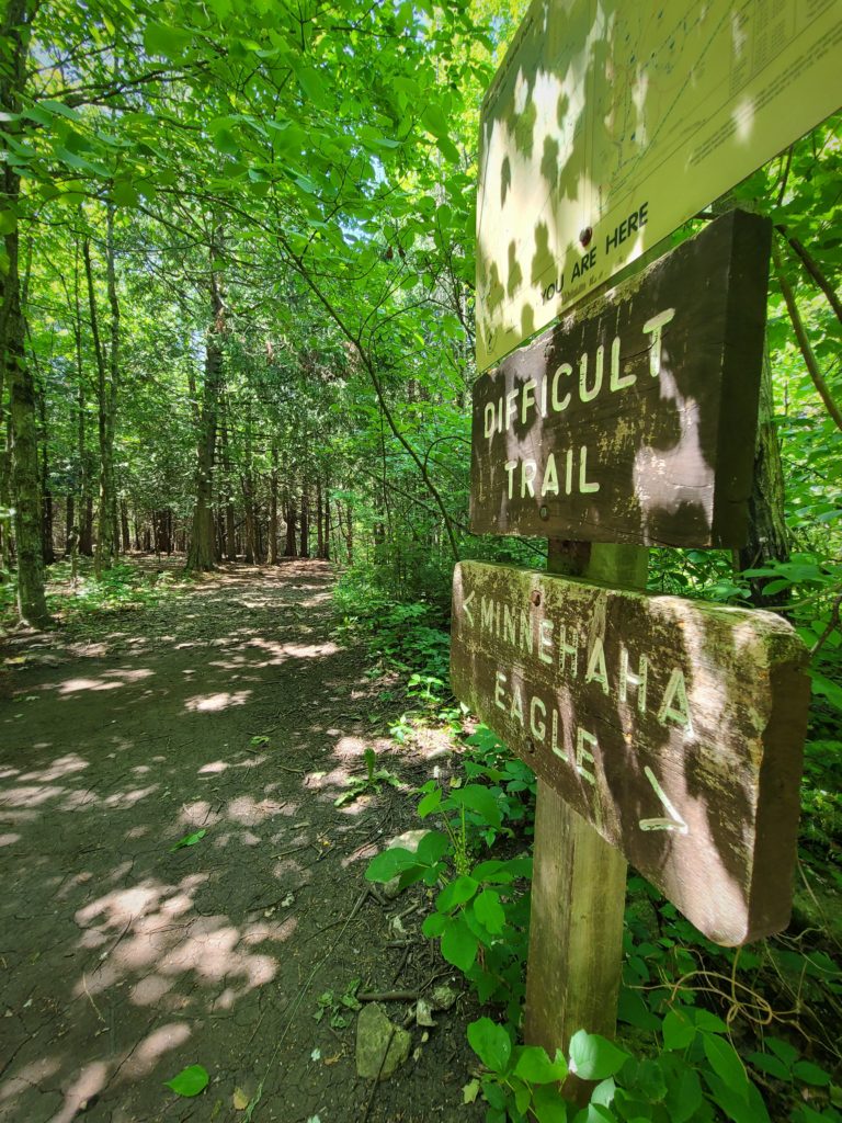
For the newbie distance hiker, the Minnehaha Trail provides a short, out-and-back route that lends itself to gently easing into hiking with gear. The trail begins by site 844 in the South Nicolet Campground, so you’ll either start your hike by parking at Nicolet Beach and walking the road through the campground to the start of the trail, or parking at the lookout on Skyline Road. If parking on Skyline Road, you’ll walk 0.2 miles along the road before meeting up with the Lone Pine Trail. Travel the Lone Pine Trail north and down a rocky switchback before crossing Shore Road and heading into the campground where Lone Pine meets the Minnehaha Trail.
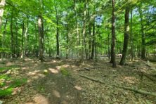
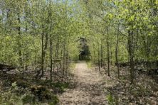
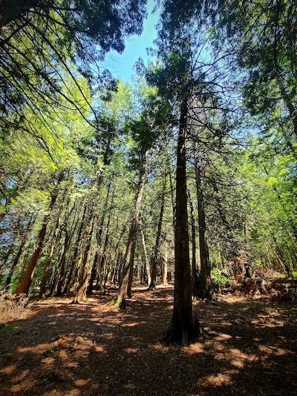
The start of the 0.7-mile Minnehaha Trail is shaded by a hall of arborvitae, with a view of Nicolet Bay peeking through the trees to the north. Heading east, the path is wide and flat. A light covering of debris from the canopy above makes the surface soft and comfortable to walk on. Minimal roots and rocks at the beginning of the trail make it an ideal place to take hiking gear on a trial run, break in those new hiking shoes, get familiar with the weight of the pack and perfect your trekking-pole technique.
The trail surface remains unchanged for about the next quarter mile or so, providing ample time to find your groove before the trail narrows a bit and a few more rocks and roots begin to appear. There’s no incline here, so enjoy the Keeping Your Footing 101 learning opportunity that this section of the trail provides.
If using trekking poles, the general rule is to grasp the pole so that your elbows are bent at a 90-degree angle and your forearms are parallel to the ground. Shorten the poles when climbing uphill, and lengthen them when traveling downhill.
When it comes to footwear, I’m a firm believer in hiking in whatever is most comfortable, but whether you choose trail runners, hiking sandals or hiking boots, you’ll want to walk some miles in your own shoes before setting out on a longer hike. The distance of the Minnehaha Trail – especially if hiked as an out-and-back route – should tell you pretty quickly whether your shoes offer enough support, are too tight or too loose in the toe box, or are rubbing anywhere that could cause blisters.
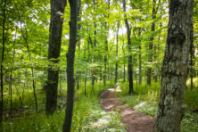
Passing by the group camping area to the south, more rocks and roots begin to appear, but by now you have the hang of picking up your feet and paying attention to the next step ahead (though I admit that the surrounding scenery will tempt you to turn your gaze away from the trail).
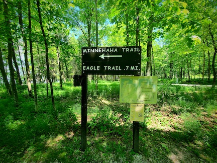
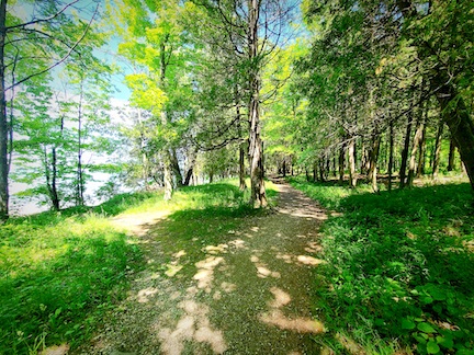
The roots and rocks dissipate and then reappear as you approach the intersection with Eagle Trail, and this time, the slightest inclines join the journey. Not to worry, though: By now, you’re moving along with increased confidence – maybe even enough to venture down one of the side paths that lead to the shoreline for a view of the water.
Returning to the trail, a bench awaits where the Minnehaha Trail meets Eagle Trail: a welcome reward for your first go at hiking with your gear.
Where: Peninsula State Park
Distance: 0.7 miles (one way)
Difficulty: Easy, but watch for sections with exposed tree roots and large rocks.
Highlights: Ideal for beginning hikers and families with young hikers, this mostly flat, wide path meanders through a forested area with glimpses of the bay through the trees.