Land Map Updated
- Share
- Tweet
- Pin
- Share
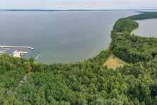
A cooperative effort to update the current vegetation, water and urban land data in Wisconsin will use data collected from satellites to map more than 40 different types of land cover commonly found in Wisconsin.
The Wisconsin Department of Natural Resources and University of Wisconsin-Madison are working together on the project, titled Wiscland 2.0, which will replace the current land cover map created by DNR that uses data collected from 1991 to 1993. While the project will help the DNR Forestry Division map the distribution of tree types statewide, it will also serve to greatly improve whitetail deer habitat monitoring.
An updated statewide land cover database was a key recommendation as part of Dr. James Kroll’s 2012 Deer Trustee Report. New mapping systems will be used to monitor biodiversity, habitat loss and track land management decisions over time.
While Wiscland 2.0 will use data from satellites to map more than 40 different types of land cover commonly found in Wisconsin, the project will also include work on the ground to gather data and assure accuracy. The tentative goal is to have the Wiscland 2.0 land cover map completed by June 2015.
An email distribution list has been created for anyone interested in receiving updates from the project team. To join, send a blank email to [email protected] and follow the instructions.